


Two storm systems making their way through the country Wednesday morning are causing accidents and damage from Washington state to Texas. They will continue to cause havoc throughout the next few days as holiday travel hits its peak.
Southern storms brought damaging winds overnight to eastern Texas, uprooting trees and causing damage to homes.
The same storm system is bringing lightning, gusty winds and heavy rain this morning from Louisiana to Tennessee.
A flash flood watch has been issued for Wednesday morning in parts of northern Alabama and southern Tennessee with 2 to 3 inches of rain falling very quickly.
The storm system moves into Georgia, South Carolina and North Carolina Wednesday afternoon, bringing heavy rain, lightning and gusty winds.
Another storm will bring more rain to the South, which means over the next several days some areas could see 4 to 5 inches of additional rainfall. More flooding is possible by this weekend.
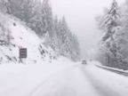
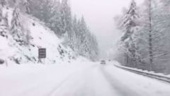
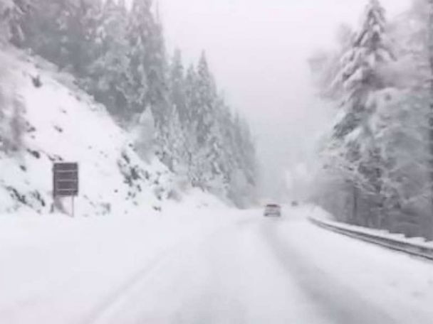
The second, colder storm system that is moving through the Rockies on Wednesday has brought 2 to 3 feet of snow to Washington and Oregon, where numerous accidents and spin outs have been reported.
The storm system is bringing rain showers to central California and heavy snow to the Intermountain West on Wednesday morning.
By Thursday, the storm will move into the central Plains, spreading snow from Colorado to Wisconsin.
The storm system moves into the Northeast Friday with snow from western New York to Massachusetts and Maine. An associated cold front will stretch all the way to the Deep South, where flooding rain and lightning are possible from Dallas to Memphis, Tennessee.
Rain will fall in the I-95 corridor on Saturday from Washington, D.C. to Boston, but behind it the rain will be changing to snow for western Pennsylvania, New York and into New England. Roads will be slick in the Northeast for your holiday travel.
The storm system will bring several more feet of snow to the Rockies and 3 to 5 inches of snow from Midwest into the Northeast.
A cold front will move into Southern California Wednesday, bringing strong winds to the Thomas fire area in Ventura and Santa Barbara counties.
Red flag warnings, fire weather watches and wind advisories have been issued from Santa Barbara, California to Los Angeles through Friday morning.
The National Weather Service is warning of dangerous fire conditions with gusty winds today. It is saying winds could be erratic with strong gusts of 40 to 50 mph, and near 60 mph in the mountains.
After the cold front moves through, gusty northerly winds remain through Friday morning in Santa Barbara, Ventura and Los Angeles counties.