


Dallas, Shreveport and Little Rock are in the bulls’-eye on Thursday.
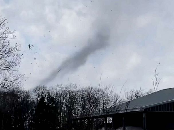
A cross-country storm that first brought blizzard conditions to the West is now taking aim on the Heartland and the South, where a dangerous severe weather outbreak is expected on Thursday.
Cities in the in the bulls’-eye Thursday afternoon and evening are Dallas, Shreveport and Little Rock. The storms will also move through Memphis, Austin and Houston.
The forecast calls for intense tornadoes, huge hail and powerful winds topping 75 mph.
Residents from Houston to Memphis need to be alert through the overnight hours.
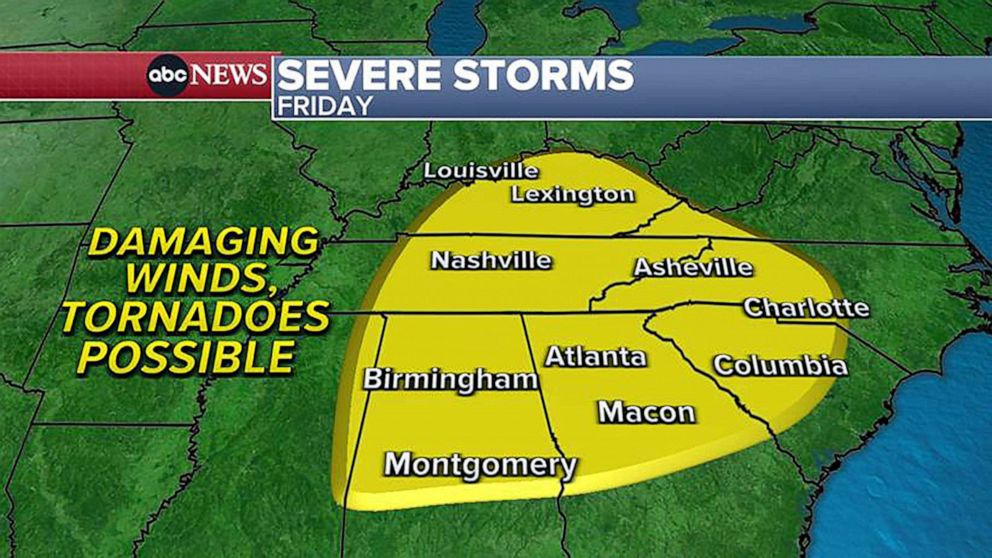
Friday’s forecast for severe weather outbreak
ABC News
On Friday, the damaging winds and tornadoes will move into the Southeast and up to the Ohio Valley.
Atlanta, Birmingham, Charlotte, Nashville and Lexington, Kentucky, will be in the bulls’-eye.
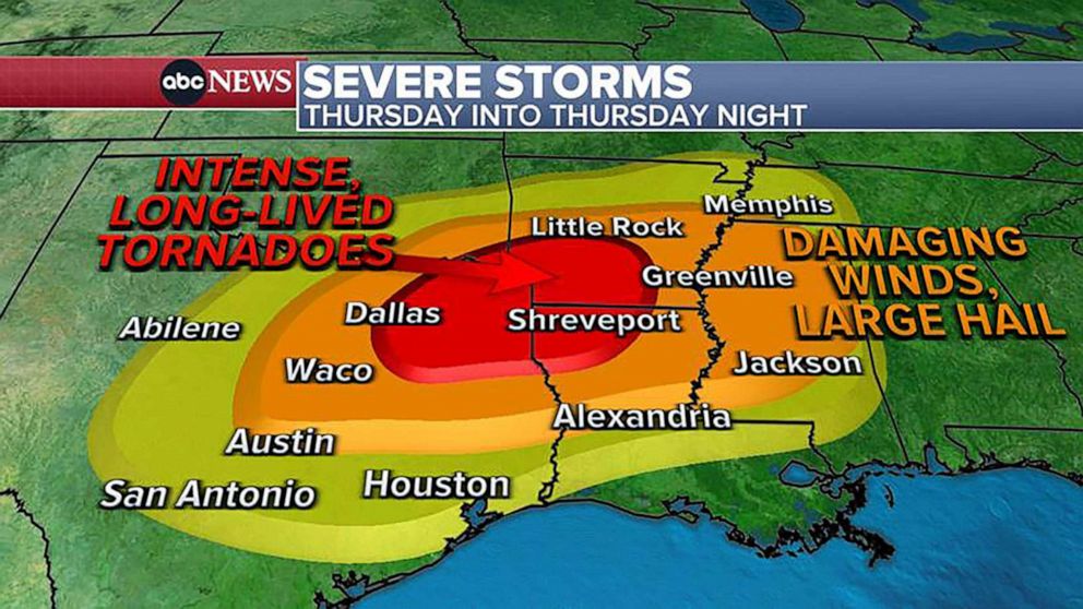
Thursday’s forecast for severe weather outbreak
ABC News
Very heavy rain — up to 5 inches — is also possible with these severe storms. Flash flooding is a threat from Oklahoma to Ohio.
To the north, that same system could bring the biggest snowstorm of the season to Chicago on Friday. More than 6 inches of snow is possible in the Windy City, where a winter storm watch is in effect. Detroit could get up to 8 inches of snow.
Heavy rain and flooding will also be possible across the Ohio Valley on Friday, from Charleston, West Virginia, to Cleveland.
The storm will move to the Northeast Friday evening.
Heavy rain is in the forecast for New York City, Philadelphia, and Washington, D.C.
Heavy snow nearing 1 foot is expected for New England. Boston with likely see a mix of rain and snow mix.
Related Topics

