
Another winter storm spanning multiple days will be moving into California Saturday night and is expected to last until Tuesday or Wednesday.
The National Weather Service is calling the system “the largest storm of the season” and is expecting the storm to have “dangerous, even life-threatening impacts.”
The strong storm is expected to drop 3 to 6 inches of rain in the valleys and coastal communities and 6 to 12 inches in the mountains. Much of the downpour is expected to occur during a 24 to 36-hour period from Sunday into Monday.
A flood watch will go into effect from Sunday afternoon through Tuesday for the entire coast of Southern California including, Santa Barbara, Ventura, Los Angeles, and Orange Counties. Other parts of California that will be hit by the deluge include the Bay Area and Sacramento.
High winds expected in Southern California
A winter storm watch will be in effect in the eastern San Gabriel Mountains from Saturday night through Tuesday afternoon, with forecasters predicting as much as 2 to 4 feet of snow above 7,000 feet, as much as 20 inches as low as 6,000 feet, and 8 inches at 5,000 feet. Winds will also gust in that area at 80 mph.
Extra shelters are expected to be open on Saturday and Sunday to accommodate the homeless population in Los Angeles. Residents can also call 2-1-1 for transportation to a shelter.
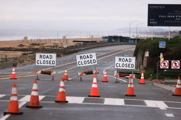
Los Angeles Mayor Karen Bass announced several measures the city is taking to weather the storm and is encouraging residents to stay home on Sunday.
LA County Public Works has issued a phase 3 mudflow forecast for the Fish Fire area in the city of Duarte. Mel Canyon Road in the city of Duarte will remain closed from Brookridge Road to Fish Canyon Road starting Sunday, February 4, at 6 PM until Tuesday, February 6, at 10 AM.
There are evacuation orders and warnings in place for areas in Ventura County starting at 5 p.m. on Saturday until 5 p.m. on Sunday.
A flood watch will be in effect in the Bay Area
For most of the Bay Area, a Flood Watch took effect beginning at 4 p.m. Saturday and running until 10 a.m. Monday. Wind advisories will begin on Saturday night, with widespread 40 mph or greater wind gusts expected.
Wind is likely to be a bigger threat than Wednesday’s storm. The strongest winds will occur Sunday morning and will be capable of significant tree damage with rain-saturated soils around the region. There will be high wind warnings in Santa Cruz and Castroville as well beginning Saturday night.
Excessive rainfall will hit Sacramento area
Sacramento will be mostly dry until Saturday night, with the bulk of the rain arriving early Sunday and continuing through the afternoon. Snow will begin to pick up across the Sierra as this storm moves in from the south, forecasters say.
Wind gusts up to 60 to 70 mph will hit the Sacramento Valley, San Joaquin Valley and foothills. Sierra mountain passes and peaks could see gusts of 70-plus mph.
The NWS has issued a High Wind Warning starting at 2 a.m. Sunday through 4 a.m. Downed trees and widespread power outages will be possible. Excessive rainfall possibly resulting in flooding will hit the area, and a Flood Watch will be in effect from Sunday to Monday.
Excessive rainfall will result in flooding of rivers, creeks, streams and flood-prone areas, the NWS says. Creeks and streams may rise out of their banks. Flooding may occur in poor drainage areas and urban areas on local roads where drains become clogged
— CBS Bay Area, Bay City News Service, and Ashley Nanfria contributed to this report.
