Michael now “extremely dangerous” Category 4 hurricane
Hurricane Michael strengthened into a fierce Category 4 storm early Wednesday, with maximum sustained winds of 130 mph, the National Hurricane Center said.
Forecasters said Michael could produce a life-threatening storm surge as high as 13 feet in some areas and as much as a foot of rain in some spots.
As of 2 a.m., Michael was some 180 miles south-southwest of Panama City, Florida and about 170 miles southwest of Apalachicola, Florida, moving due north at a steady clip of 12 mph.
“On its forecast track,” the center said, “the center of Michael will move across the northeastern Gulf of Mexico this morning. The center of Michael’s eye is then expected to move inland over the Florida Panhandle or Florida Big Bend area later today, move northeastward across the southeastern United States tonight and Thursday, and then move off the Mid-Atlantic coast away from the United States on Friday.”
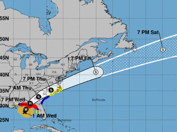
Hurricane Michael’s projected path as of 2 a.m. EDT on Wed., Oct. 10, 2018.
” … Some additional strengthening is possible today before Michael makes landfall in the Florida Panhandle or the Florida Big Bend area. Weakening is expected after landfall as Michael moves across the Southeastern United States.”
Hurricane-force winds extended outward up to 45 miles from Michael’s eye and tropical-storm-force winds extended outward up to 175 miles.
The NHC said Michael will also up the threat of tornadoes Wednesday for parts of the Florida Panhandle, the northern Florida Peninsula and Southern Georgia.