


A strong frontal system on Friday brought a round of severe weather to parts of Colorado and the High Plains, including thunderstorms and a reported tornado in Falcon, Colorado. Additionally, parts of Colorado received accumulating hail and snow as colder air moved in behind the frontal system.
The system stretched across a large swath of the central and eastern U.S. on Saturday morning. Snow was falling behind the frontal system in parts of Kansas and Nebraska, as well as parts of Michigan. On the warmer side of the frontal system, strong storms were forming, with heavy rain, gusty winds and some hail.
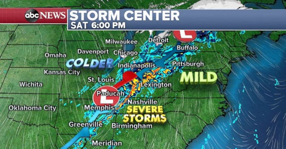 (ABC News) A strong front is set to move through the Ohio and Tennessee River valleys on Saturday.
The entire frontal system will move east on Saturday and bring a good shot of heavy rain for the Mississippi and Ohio River valleys. Locally, over an inch of rain is possible in the heaviest downpours, especially across the Ohio River Valley. Most snow should come to an end without much of an impact.
Some of the storms forming along the front could turn severe in parts of the Tennessee Valley late in the afternoon.
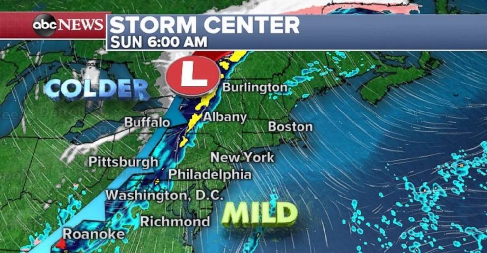 (ABC News) The storms will weaken by the time they reach the East Coast on Sunday.
There is a slight risk for severe weather Saturday across parts of Mississippi, Alabama and Tennessee. Damaging winds, large hail and brief tornadoes are the main threat. The threat is highest on Saturday evening and winds down after the sun sets.
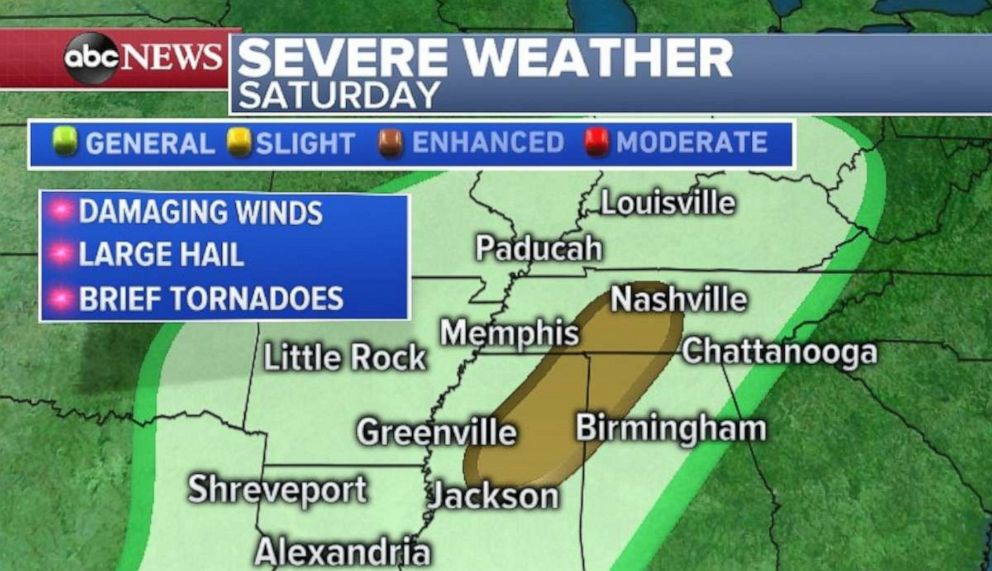 (ABC News) Damaging wind, hail and brief tornadoes are possible in the Tennessee River Valley on Saturday.
By Sunday the frontal system will approach the Northeast, however, the front is losing its intensity, moving rapidly and will not have the same amount of instability. It is unlikely that any of the storms forming along the front will be severe. There will be a couple of rain showers, with some occasional gusts and a rumble of thunder, though.
Snow showers will begin to form off the lakes behind the front and move through parts of the interior Northeast on Sunday afternoon.
Mild Saturday in the East
An additional effect of this frontal system will be the very mild air surging ahead of it. Parts of the Deep South will see temperatures into the 70s Saturday, a couple of degrees above average. Atlanta, which averages around 69 for late March, will be in the mid-70s.
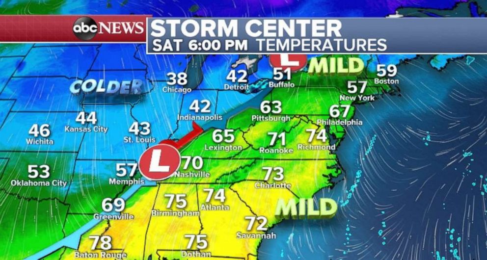 (ABC News) Temperatures on the East Coast will be mild ahead of the storm front.
The frontal system is a classic spring cold front, where temperatures can be 20 to 30 degrees different on either side of the front. Nashville, Tennessee, will be the 70s Saturday afternoon, but just a couple hundred miles northwest in St. Louis, it will be in the 40s.
The mild air is most notable in the Mid-Atlantic and Northeast, where temperatures will be almost 70 across Virginia, Maryland, southeast Pennsylvania and New Jersey. Philadelphia averages in the upper 50s for late March, but Saturday it will be heading toward the 60s. New York City’s high temperature will be somewhat limited due to some cooler air coming off the water.
This is the warmest weather the East Coast has seen since late fall in 2018 — a welcome relief for many.
