


The storm reached Padre Island around 5 p.m. local time.
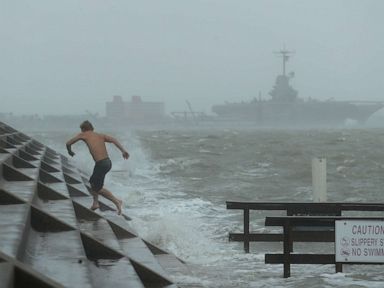
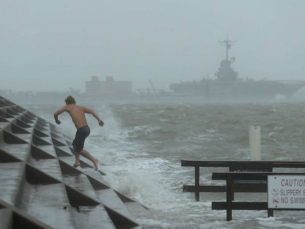
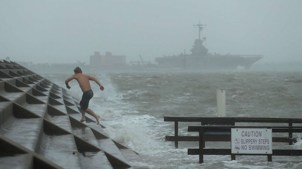
Hurricane Hanna battered southern Texas with sustained winds of 85 mph and continued to deliver heavy rain and flash flooding as it moved inland late Saturday.
The Category 1 hurricane was moving west at about 8 mph when it made landfall at Padre Island, about 15 miles north of Port Mansfield, around 5 p.m. local time on Saturday.
Very heavy rain, strong winds and storm surge impacted the south Texas coast, the worst of it south of Corpus Christi, down to the mouth of the Rio Grande River.
While wind and storm surge were notable along the coast during the afternoon, very heavy rain and the potential for widespread flash flooding across the Rio Grande Valley was the biggest concern into Saturday night. Rainfall totals over extreme southern Texas to the Mexico border could lead to dangerous flash flooding.
“Any hurricane is an enormous challenge, this challenge is complicated and made even more severe seeing it is sweeping through an area that is the most challenged area in the state for COVID-19,” said Texas Gov. Greg Abbott. “We cannot allow this hurricane to lead to a more deadly event by stoking COVID-19 leading to more fatalities.”
Abbot said disaster declarations have been made in 32 counties.
The National Weather Service in Brownsville reported “significant structural damage” in nearby Port Mansfield and a gust up to 83 mph.
As is usually the case with land-falling tropical systems, isolated tornadoes are possible along the southern Texas coast through Saturday evening.
Hanna will begin to rapidly weaken Saturday tonight and Sunday morning as it moves into northern Mexico. However, it will continue to bring widespread heavy rain and the threat of dangerous flash flooding across the Rio Grande Valley even as the wind speeds go down.
An excessive amount of rain is forecast for extreme southern Texas, south of Corpus Christi, including Port Mansfield, Brownsville and down along parts of the Rio Grande Valley. Rainfall totals of 6 to 12 inches are expected which could produce widespread flash flooding.
Isolated rain totals of over a foot are possible into early Sunday as Hanna begins to moves into northern Mexico.
Hurricane Douglas approaches Hawaii
Meanwhile near Hawaii, Hurricane Douglas weakened to a Category 1 hurricane with sustained winds down to 90 mph Saturday afternoon local time. It was moving west-northwest at 16 mph and was about 300 miles east of the Big lsland at 4 p.m.
A hurricane warning is in effect for Oahu, including Honolulu. A tropical storm warning is in effect for the Big Island and Maui, while a tropical storm watch is in effect for Kauai.
The weakening trend will continue as it closes in on Hawaii and Douglas will pass near the islands on Sunday. It will likely pass close enough for heavy rain, strong winds and rough surf to impact parts of the state. However, a slight shift in the track could change impacts either way.
Douglas will impact the islands as a low-end Category 1 hurricane. While wind and coastal impacts are a concern, very heavy rain will likely be the biggest impact with several inches possible and the potential for flash flooding, landslides and mudslides.
On the current track, the island of Maui and higher elevations have the greatest chance of bearing the worst impact.
On Saturday, President Donald Trump approved Hawaii’s emergency declaration request in response to Hurricane Douglas. The request allows Federal Emergency Management Agency to coordinate emergency response efforts.
ABC News’ Allison Pecorin contributed to this report.
